ABOUT
This mapping system refers to the research project Reflexive mapping on Covid-19. From geolocalisation to the importance of its territorial dimension directed by Emanuela Casti and Fulvio Adobati.
The research result is the following book: E. Casti with F. Adobati and I. Negri (Eds.), Mapping the Epidemic. A Systemic Geography of COVID-19 in Italy, Elsevier, Amsterdam, 2021.
It analyzes contagion trends and the spread of Covid-19 in Italy in relation to territorial features, with a focus on the Lombardy Region, most severely affected. Research begun in February 2020, as a group of researchers from the University of Bergamo began monitoring the first epidemic "wave” in Italy of viral infection coming from China, which subsequently spread to Europe and the entire world. Monitoring ceased at the end of June, when the epidemic entered an endemic phase and lockdown measures adopted to contain it were finally lifted.
This initial, intense period of health emergency in Italy is crucially important for shedding light on the epidemiological dynamics of the disease, for pinpointing potential flaws in our pattern of urban living in times of Covid-19 and, finally, for assessing measures that were put in place to stem infection and safeguard the functioning of the healthcare system.
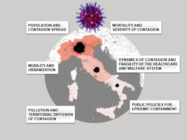
The research cohesively unfolds in six chapters written by different authors around one major research proposition: namely that the intensity and severity of epidemic spread are influenced by territory and precisely by the presence / absence of some geophysical and / or social aspects.
Theoretical grounding is discussed in the introduction, and issues of theory are subsequently picked up in turn by each chapter, in focused analyses of the spatio-temporal evolution of multi-scale epidemic in Italy, visualized via reflexive mapping. Indeed, this research proposes a cartography that alludes to the social sense of territory by distorting the topographic map base, implementing it and treating it via choices and techniques that are dictated by “other” metrics: for instance, “chorographic” metrics, aimed at representing the social relevance of territory.
That is where cybercartography comes in: a chorographic dynamics that relies on multimedia and shifting perspectives to represent a space-time dimension which reclaims the social value of territory, in our specific case with regard to viral contagion.
If you have questions, please contact: diathesis@unibg.it
